See bottom for earlier updates
Temperatures crested in the mid- and upper 80s today. With the humidity in the air, it felt more like 90s. The combo of heat and humidity has also kicked off some storms to our west that are moving into the area. They’re with us into evening, with the potential for damaging winds and some hail, along with downpours.
Listen to our daily D.C. forecasts: Apple Podcasts | Amazon Echo | More options
Through tonight: Scattered showers and storms continue through this evening. Storms could be intense locally, with some wind damage possible, along with heavy rain and active lightning. Flooding is also possible. Another storm could pass around midnight. Temperatures range from about 70 to the mid-70s. Winds are from the south-southwest around 10 mph.
View the current weather at The Washington Post.
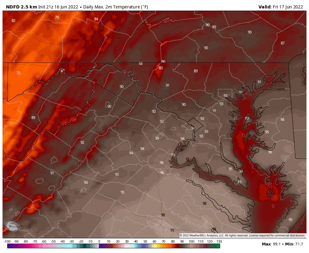
Tomorrow (Friday): Partly to mostly sunny and hot conditions are here for the end of the workweek. High temperatures are in the low and mid-90s. Winds are from the west around 10 to 20 mph, with gusts near 30 mph. A storm is possible, but probably south and southeast of our area.
See David Streit’s forecast through the weekend. And if you haven’t already, join us on Facebook and follow us on Twitter and Instagram. For related traffic news, check out Gridlock.
Want our 5 a.m. forecast delivered to your email inbox? Subscribe here.
5:10 p.m. update — Showers and storms struggling
The prior severe thunderstorm warning was canceled early. Storms locally have weakened a good deal lately, although plentiful lightning and thunder have been ongoing for an hour or more in western parts of the area.
It appears relative stability from a marine airmass east of the Blue Ridge may tend to kill off the local activity as stronger storms run south toward Culpeper and Spotsylvania. There is also yet another line of broken storms in Pennsylvania that could approach later tonight. We’ll keep an eye out.
4:40 p.m. update — Severe storm over western suburbs
A severe thunderstorm warning is in effect for parts of Montgomery, Loudoun, and Fairfax counties until 5:15 p.m. A risk of damaging winds and small hail is present in this storm.
While storms were more intense to the west, they did drop some impressive hail. Additional hail to an inch or even larger is possible should storms pulse up as they pass.