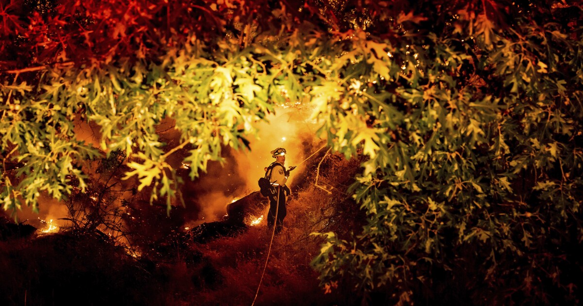
A fast-growing wildfire burning along the border of Amador and Calaveras counties swelled past 3,000 acres on Tuesday and poses a “continued threat to critical power infrastructure,” the California Department of Forestry and Fire Protection said.
The Electra fire ignited Monday afternoon near the North Fork of the Mokelumne River and spread quickly amid dry brush and steep terrain, according to Cal Fire Battalion Chief Jon Heggie.
“I went to bed last night knowing it was over 1,000 acres, and now we’re closely watching it as it has the potential to become a large fire,” Heggie said Tuesday.
The fire had burned 3,034 acres Tuesday afternoon and was 0% contained.
Approximately 100 visitors and employees were evacuated Monday night from the Electra powerhouse, a Pacific Gas & Electric hydropower facility, Cal Fire said.
More than 15,000 customers in the area were without power Tuesday morning, according to PG&E spokeswoman Megan McFarland.
“PG&E has a number of assets potentially at risk due to the fire,” McFarland said via email. “We are currently working with Cal Fire to gain access to impacted areas to make assessments. PG&E also has five Safety and Infrastructure Protection engines working to treat assets that could be impacted by the fire.”
PG&E has also “deenergized several distribution lines for firefighter safety” at the request of Cal Fire, she said.
The fire has prompted mandatory evacuation orders in both Amador and Calaveras counties, where at least 450 structures are threatened.
Evacuation orders in Amador County include homes on all roads south of Butte Mountain Road from South Clinton Road to Amador Lane.
Evacuation orders in Calaveras County include areas north of Highway 26 from Montgomery Drive to Lower Dorray Road.
Multiple roads are closed to traffic entering those areas, including State Route 26 in both directions.
Heggie said the fire is burning in rugged, steep terrain, “which is creating accessibility issues.” Images captured by wildfire cameras on Monday and Tuesday showed the blaze had formed a large pyrocumulus cloud, signaling intense heat.
“It’s smoky. From my office right now, I can see the plume looks like it’s picking up,” said Jarret Benov, operations captain with the Amador County Sheriff’s Office.
Benov said the area where the fire is burning is home to “a lot of vegetation, trees, grasses and fuels.”
“It’s a mountain community where a lot of homes are on a half-acre, an acre, and are pretty forested,” he said.
Benov said the frequency of wildfires in the region has increased in recent years.
“We had fires, but it wasn’t every year where you’re thinking, ‘Fire season is upon us again, here we go,’ and you have them all summer long,” he said.
The blaze is burning not far from where the Butte fire seared through about 70,000 acres in 2015, but Cal Fire spokeswoman Diana Swart said there has been too much regrowth in the years since for its footprint to act as much of a deterrent.
“The vegetation has grown back,” she said. “That’s a very grassy area; those grasses grow back year after year, so unfortunately we don’t have a burn scar fresh enough that would really be that much of a help to us.”
The Red Cross has opened two evacuation centers near the fire, including the Italian Picnic Grounds in Sutter Creek and the San Andreas Town Hall in San Andreas.
There is a large and small animal shelter at the Amador County Fairgrounds. Small animals can shelter with owners at the San Andreas Town Hall.
More than 1,200 personnel are attacking the fire from the air and ground, Cal Fire said, and more were en route in the afternoon.
The agency said on Twitter that more than 128 engine companies, 22 water tenders, 33 bulldozers, 39 hand crews and multiple aircraft were working to establish containment lines.
The priority on Tuesday is keeping the fire east of Highway 49 and south of Highway 88, north of Jesus Maria Road and west of Highway 26 and Railroad Flat Road, officials said.
Weather conditions over the fire were somewhat favorable, including relatively low winds and high humidity, according to meteorologist Eric Kurth with the National Weather Service in Sacramento.
However, there have been reports of fire-related smoke and air quality issues in the San Joaquin Valley. Kurth said shifting wind patterns in the afternoon could push it toward South Lake Tahoe. Residents who see or smell smoke are advised to limit outdoor activities and use an air filter for protection.
At least one firefighter has been injured battling the blaze, according to Swart. She could not confirm the nature of the injury but said it was minor.
Swart said the initial report of the fire came from Highway 49 and Electra Road — a “very narrow, windy, rutty road” that leads to the PG&E powerhouse. The area is also popular for recreation because of its proximity to the river, she said.
The cause of the fire remains under investigation, she said.
