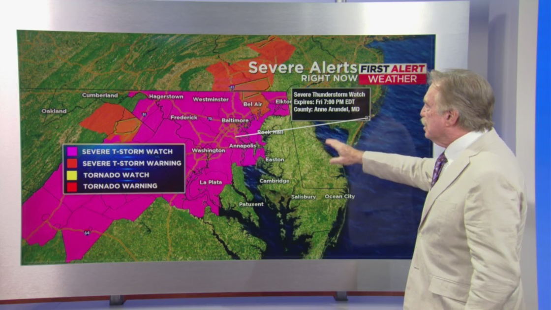
BALTIMORE (WJZ) — The National Weather Service has issued a severe thunderstorm watch for 13 counties in Maryland until 9 p.m. on Saturday.
The watch warning was raised for Anne Arundel, Howard, Montgomery, Prince Georges, Carroll, Frederick, Cecil, Harford, Calvert, Charles, Saint Mary’s, and Baltimore Counties.
READ MORE: High Court Marshal Seeks Enforcement Of Anti-Picketing Laws
Baltimore City is also in the path of the storm.
Additionally, a flash flood warning has been issued for Frederick, Middletown, Braddock Heights, Rising Sun, Fair Hill, Bay View, and Cecil County until 10 p.m., according to the National Weather Service
LWX issues Flash Flood Warning [flash flood: radar indicated] for Cecil [MD] till Jul 2, 10:00 PM EDT https://t.co/Xx0SdCamd9 pic.twitter.com/GCWQZgj2mE
— Howard Bernstein (@hbwx) July 2, 2022
Forecasters initially predicted that storms would develop across Western and Central Maryland, east of Interstate 81, between 3 p.m. and 5 p.m.
The storms were expected to track toward Interstate 95 by early evening.
Wind damage will be the main threat from gusty winds in storms in the evening.
A few of the storms may produce hail, possibly even nickel-size hail.
The storms will move through the Baltimore area around 6–7 p.m. and then move over to the Eastern Shore and Southern Maryland early tonight after sunset.
READ MORE: Fourth Of July Fireworks Return To Baltimore’s Inner Harbor
Storm chances in the Baltimore area will end tonight. Afterward, there will be mostly cloudy skies.
Sunday will initially appear to be mostly cloudy with those clouds clearing by late morning and afternoon.
The level of humidity will decrease too.
It should be a great day with high temperatures in the mid-80s.
The Fourth of July looks hot and sunny with temperature highs in the upper 80s.
The weather on the federal holiday should be perfect for fireworks and cookouts.
Storm chances return on Tuesday afternoon and continue off and on through Friday.
MORE NEWS: 19-Year-Old Man Shot In Baltimore’s Upton Neighborhood Saturday, Police Say